
 Skip to content
Editorial note: This guide is desk research based only on current Bureau of Land Management and USDA Forest Service pages and orders, checked August 2, 2026. Local orders, posted signs, closures, permits and fire restrictions can be more restrictive than a general agency page. This is planning information, not legal advice or permission to occupy any particular site. See our editorial policy and data sources and methodology.
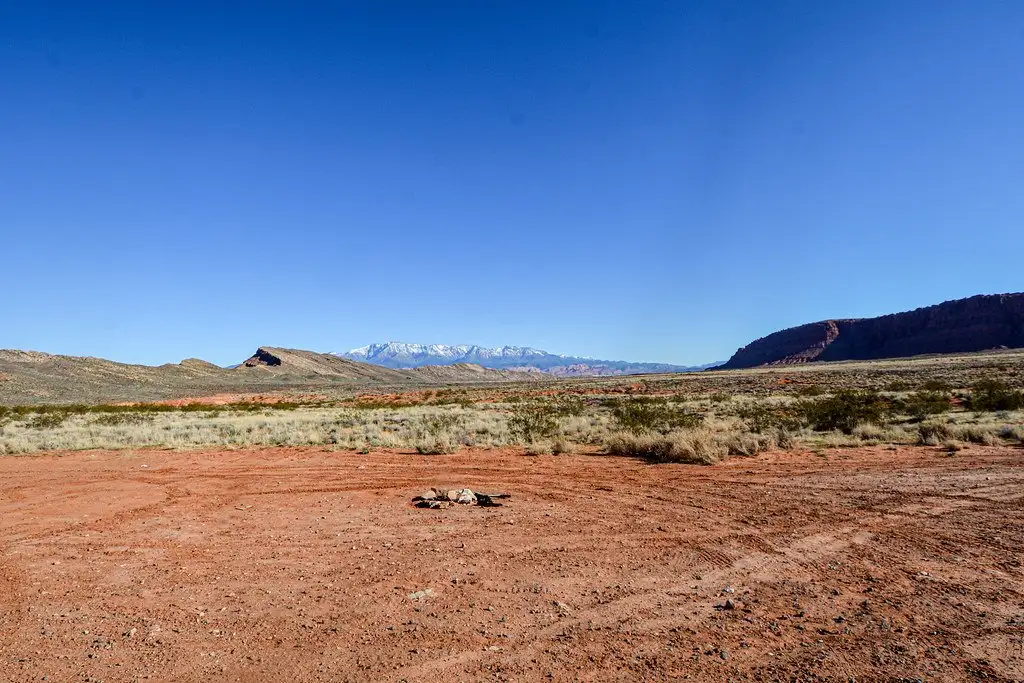
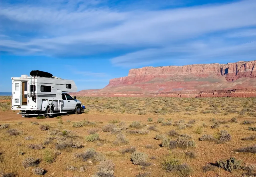
Featured photo: An established dispersed campsite on BLM-managed public land. Photo by Jeremy T. Dyer, BLM Utah. Public domain via the official BLM Utah record. Context only—verify the current local order before camping.
Disclosure: some links in this guide go to Amazon. Ticheka Outdoors is a participant in the Amazon Services LLC Associates Program. As an Amazon Associate I earn from qualifying purchases, at no extra cost to you. Affiliate links never change what we include, how we rank it, or what we say about it. See our affiliate disclosure and editorial policy.
Quick answer
“Boondocking” is the common RV term for dispersed camping outside a developed campground. The BLM says most BLM-managed lands allow dispersed camping unless an area is posted closed or has specific restrictions. Its national camping page gives a general stay limit of 14 days within a 28-day period, but immediately says limits vary by state and field office; after the applicable limit, the required move is often 25–30 miles. Treat those numbers as a prompt to check the local rule, not as nationwide permission.
National Forest rules also differ by unit. For example, the Willamette National Forest publishes a maximum of 14 days out of every 60, while the Chequamegon-Nicolet National Forest’s current general occupancy order prohibits dispersed camping in the same location for more than 21 days in a 28-day period and requires other forest occupancy in that period to be at least one road mile away. The safe workflow is always: exact land manager → current unit page and orders → current motorized-access map → alerts and fire restrictions → written stay and waste plan.
Step 1: Identify the exact land manager and unit
- BLM-managed land: start with the BLM’s official map and the field office responsible for the exact location. “Public land” is not a single rule set, and a crowdsourced camping pin is not proof that an overnight stay is allowed.
- National Forest System land: identify the national forest and ranger district, then open that unit’s alerts, orders and current Motor Vehicle Use Map (MVUM). The Olympic National Forest, for example, defines dispersed camping as camping outside a designated campground and warns that little or no facilities are provided.
- Any other ownership: stop and use that owner’s rules. This article does not transfer BLM or Forest Service guidance to state, county, tribal, municipal or private land.
If the map boundary, access road, or managing office is unclear, do not solve the uncertainty by parking. Save the office contact and ask for the rule that covers the precise area.
Step 2: Replace the myths with a source check
| Common shortcut | Safer reading of the official source | Official source |
|---|---|---|
| “BLM always means 14 days, then 25 miles.” | The BLM calls 14 days in 28 a general limit, says state and field-office limits vary, and says the required move is often 25–30 miles. Check the responsible office. | BLM camping page |
| “Every National Forest uses 14 days.” | Published unit rules differ. Willamette states 14 days out of 60; Chequamegon-Nicolet’s current general order uses 21 days in 28 for the same dispersed location plus a one-road-mile condition for other forest occupancy during that period. | Willamette · Chequamegon-Nicolet order |
| “Any visible dirt road is an access route.” | BLM’s national page says vehicles must stay on designated roads and trails unless an area is specifically designated for off-road use. On National Forest land, consult the current unit MVUM and alerts. | BLM camping page · Mt. Hood MVUM page |
| “A route on the MVUM must be drivable.” | An MVUM shows routes and areas designated for motorized use; it is not a promise that a road is maintained, passable, suitable for an RV, or unaffected by a temporary closure. Check alerts and turn around before conditions exceed the rig or driver. | Forest Service MVUM explanation |
| “An existing fire ring means a fire is allowed.” | It does not. BLM fire restrictions change during the year; the current restriction and posted guidance control. If the status is unclear, do not light a fire. | BLM camping page |
| “A previously used site is automatically open.” | Previously disturbed ground is a BLM best-practice preference, not proof of current authorization. Closures, permits, local orders, route designations and posted signs still control. | BLM camping page |
Step 3: Use this verify-before-you-park workflow
- Pin the exact location, then identify the manager. Use the agency’s official map and confirm the responsible field office or ranger district. A third-party app can suggest an area; it cannot grant access.
- Open the unit page, alerts and current orders. Record the stay limit, counting period, required move, closed zones, permits and any seasonal conditions. Do not borrow a neighboring office’s rule.
- Verify motorized access separately. For National Forest travel, use the current MVUM plus the unit’s alerts. For BLM travel, follow designated-route rules and local travel-management information. A line on a map does not certify clearance, surface, weather, or turnaround room.
- Check fire restrictions on departure day. An old screenshot, a cold fire ring, or another camper’s fire is not authorization. If a fire is permitted, follow the current local conditions and fully extinguish it before leaving.
- Make a conservative waste plan. BLM recommends a portable toilet or packing out human waste where possible and notes that local disposal rules vary. BLM New Mexico, as one local example, prohibits disposal of refuse, sewage or gray water in a way that pollutes the area. Carry waste out and use an authorized disposal facility unless the managing office gives a different, applicable instruction. Our water, tanks and dump-station guide covers capacity planning.
- Use an already disturbed site only when access and camping are allowed. The BLM lists existing sites as a best practice and recommends camping near designated routes; those recommendations do not override a closure, order, permit zone, MVUM designation or posted sign.
- Set and log the stay clock. Write down night one, the applicable counting window, the last allowed night and the office-specific relocation rule.
- Save proof offline. Download the current order, map, alert page and office contact before losing service. If two official sources conflict, ask the managing office and follow the more restrictive reading until clarified.
A conservative first-trip framework
The following are Ticheka planning recommendations, not agency rules:
- Start with one or two nights. Learn the rig’s real water, waste, battery and temperature performance before attempting a longer stay.
- Choose a turnaround threshold in advance. Leave before water, waste, battery, weather or road conditions reach the limit; do not plan around using the final reserve.
- Arrive in daylight. Inspect surface, grade, overhead clearance, escape route and turnaround space without committing the rig.
- Assume no service. Download maps and rules and share the route and return time with a trusted contact. Connectivity options are covered in our RV internet setup guide.
- Have a no-fire meal plan. Fire restrictions can change quickly; a stove or meal plan must still comply with the current local restriction.
- Know the next authorized water and waste-disposal stop. Do not wait until a tank is full to decide where waste can be accepted.
Self-sufficiency equipment
Dispersed camping means no hookups and, in most units, pack-it-out waste rules. These links open Amazon search results by equipment class. Read the land manager rules first — equipment does not make a site legal.
- Portable solar panels
- LiFePO4 house batteries
- Portable water containers
- Portable toilets and waste bags
- Levelling blocks and recovery boards
- Satellite communicators
These are affiliate links.
Failure modes
- Crowdsourced-pin permission: treating reviews or recent check-ins as proof of land status, access or current camping authorization.
- Fourteen-day entitlement: treating a general BLM baseline as a universal right or transferring it to a National Forest.
- MVUM overconfidence: reading “designated for motorized use” as “open today, maintained and RV-safe.”
- Boundary drift: verifying a BLM or Forest Service parcel but unknowingly parking on adjacent land with different rules.
- Fire-ring assumption: lighting a fire because a ring exists without checking the current restriction and permit requirements.
- Waste improvisation: assuming gray water or human-waste disposal is allowed because another location permits a method.
- Moving the rig without reading the counting rule: relocating a short distance and assuming the stay clock reset.
Pre-trip checklist
- Exact manager, unit and office confirmed from official sources.
- Current unit page, orders, alerts and posted restrictions checked.
- Stay limit, counting period, required move and return rule written down.
- Current MVUM or BLM travel-management source downloaded; road alerts checked.
- Fire restriction and any permit requirement checked on departure day.
- Established site selected only after the current access and camping rules are checked.
- Water, waste, power and authorized disposal plan sized for the stay plus a departure reserve.
- Offline maps, office contact, route and check-in plan saved.
Print this guide
This guide prints cleanly from any browser — no plugin, no download, no sign-up. Navigation, images and site links are hidden automatically in the printed version.
Frequently asked questions
How long can you boondock in one place?
The BLM calls 14 days within a 28-day period a general limit, then says state and field-office limits vary, and that the required move is often 25 to 30 miles. Published National Forest rules differ by unit: the Willamette National Forest states 14 days out of every 60, while the Chequamegon-Nicolet general occupancy order uses 21 days in 28 for the same dispersed location and adds a one-road-mile condition for other occupancy in that period. Check the responsible office rather than assuming a national number.
Can you camp anywhere on BLM land?
No. The BLM says most BLM-managed lands allow dispersed camping unless an area is posted closed or carries specific restrictions, so the default is permissive but not unlimited. Vehicles must stay on designated roads and trails unless an area is specifically designated for off-road use, and posted seasonal orders override the general rule.
How do I know a dirt road is legal to drive?
On National Forest land, the current motor vehicle use map for that unit is the authority: it shows which routes are open, to which vehicle types, and in which seasons. An MVUM shows legal status, not condition — a listed route can still be impassable for an RV. On BLM land, stay on designated roads and trails unless the area is designated for off-road use.
How do I find out who manages the land I am on?
Pin the exact location first, then identify the managing agency and unit — a BLM field office or a specific forest and ranger district. Read that unit’s current page, closure orders and alerts, and the current motor vehicle map before you park. Crowdsourced pins, reviews and recent trip reports are not permission, and boundaries are easy to misread on the ground.
Limitations, and how to correct us
This guide reflects the linked BLM and Forest Service sources as they read on August 2, 2026. It does not determine whether any particular pullout is open, accessible, safe, suitable for an RV, fee-free or available today. Current local orders, closures, permits, fire restrictions, route designations and posted signs control. Distances on the BLM national page are expressly general; the Forest Service examples demonstrate variation and are not rules for other forests. This is planning information, not legal advice. No campsite is recommended or represented as currently authorized. Corrections are welcome under our editorial policy and corrections policy.
Sources
- Bureau of Land Management — Camping on BLM-managed land
- Bureau of Land Management — Recreation activities
- USDA Forest Service — Willamette National Forest camping
- USDA Forest Service — Chequamegon-Nicolet general occupancy order
- USDA Forest Service — Olympic National Forest camping
- USDA Forest Service — Mt. Hood motor vehicle use maps
- USDA Forest Service — What a motor vehicle use map shows
- Ticheka — Data sources and methodology